Trail Mountain bike Le Mas-de-Tence - Aux Portes du Mas de Tence - Photo
 tracegps
tracegps

User

© OpenStreetMap contributors
Length
Length
8.3 km
Max alt
Max alt
1093 m
Uphill gradient
Uphill gradient
233 m
Km-Effort
Km-Effort  
11.4 km
Min alt
Min alt
966 m
Downhill gradient
Downhill gradient
244 m
Boucle
Boucle
Yes
Creation date :
2014-12-10 00:00:00.0
Updated on :
2014-12-10 00:00:00.0

(0 Reviews)

Mountain bike
Mountain bike
1h00
Difficulty : Medium

Scan this QR Code to open this trail in the SityTrail application

FREE GPS app for hiking

Logo SityTrail SityTrail

IGN / Geographical institutes

Download SityTrail from the App Store Download SityTrail from Google Play

Logo SityTrail SityTrail World

The world is yours!

Download SityTrail from the App Store Download SityTrail from Google Play Download SityTrail on Huawei AppGallery

About

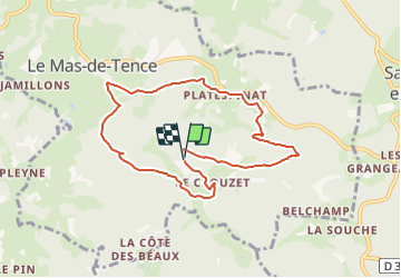
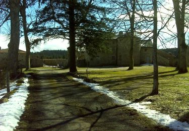
Trail Mountain bike of 8.3 km to be discovered at Auvergne-Rhône-Alpes, Haute-Loire, Le Mas-de-Tence. This trail is proposed by tracegps.

Description

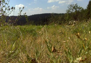
Promenade en forêt et nature sans difficultés. Calme et sérénité assurés !

Elevation profile

Photos

Positioning

Country:
France
Region :
Auvergne-Rhône-Alpes
Department/Province :
Haute-Loire
Municipality :
Le Mas-de-Tence
Location:
Unknown
Start:(UTM)
608025 ; 4996236 (31T) N.

Trails nearby

Trail Walking Montregard - Rando t'est  - Photo
Walking
jroche425@gmail.com

Walking

Easy
(1)
Montregard, Auvergne-Rhône-Alpes, Haute-Loire, France
1.1 km | 1.2 km-effort
19min
Yes
Trail Walking Saint-André-en-Vivarais - 43 st André en vivarais - Photo
Walking
himba26100

Walking

Easy
Saint-André-en-Vivarais, Auvergne-Rhône-Alpes, Ardèche, France
12.7 km | 17 km-effort
4h 33min
Yes
Trail Snowshoes Le Mas-de-Tence - Coup d'oeil à Montregard - Photo
Snowshoes
tracegps

Snowshoes

Medium
Le Mas-de-Tence, Auvergne-Rhône-Alpes, Haute-Loire, France
10.4 km | 13.2 km-effort
3h 0min
Yes
Trail Mountain bike Le Mas-de-Tence - Coup d'oeil à Montregard - Photo
Mountain bike
tracegps

Mountain bike

Medium
Le Mas-de-Tence, Auvergne-Rhône-Alpes, Haute-Loire, France
10.4 km | 13.2 km-effort
1h 0min
Yes
Trail Walking Le Mas-de-Tence - Coup d'oeil à Montregard - Photo
Walking
tracegps

Walking

Medium
Le Mas-de-Tence, Auvergne-Rhône-Alpes, Haute-Loire, France
10.4 km | 13.2 km-effort
2h 30min
Yes
Trail Walking Le Mas-de-Tence - Aux Portes du Mas de Tence - Photo
Walking
tracegps

Walking

Medium
Le Mas-de-Tence, Auvergne-Rhône-Alpes, Haute-Loire, France
8.3 km | 11.4 km-effort
2h 0min
Yes
Trail Walking Saint-Bonnet-le-Froid - Chemin de Saint Régis: Saint Bonnet le Froid - Montfaucon en Velay - Photo
Walking
tracegps

Walking

Difficult
Saint-Bonnet-le-Froid, Auvergne-Rhône-Alpes, Haute-Loire, France
24 km | 34 km-effort
8h 45min
No
Trail Mountain bike Saint-Bonnet-le-Froid - Espace VTT FFC Le Velay des 3 Rivières - N°26 La Saint Bonnette St-Bonnet-le-Froid - Photo
Mountain bike
tracegps

Mountain bike

Difficult
Saint-Bonnet-le-Froid, Auvergne-Rhône-Alpes, Haute-Loire, France
15.5 km | 22 km-effort
2h 0min
Yes
Trail Mountain bike Le Mas-de-Tence - Espace VTT FFC Le Velay des 3 Rivières - N°12 La Côte des Beaux - Le Mas de Tence - Photo
Mountain bike
tracegps

Mountain bike

Medium
Le Mas-de-Tence, Auvergne-Rhône-Alpes, Haute-Loire, France
13.7 km | 18.1 km-effort
1h 30min
Yes


Close
My subscriptions